Documents & Diagrams Diagrams
The following documents/diagrams will be presented and discussed during round table sessions.
| Organization | Description | Diagrams |
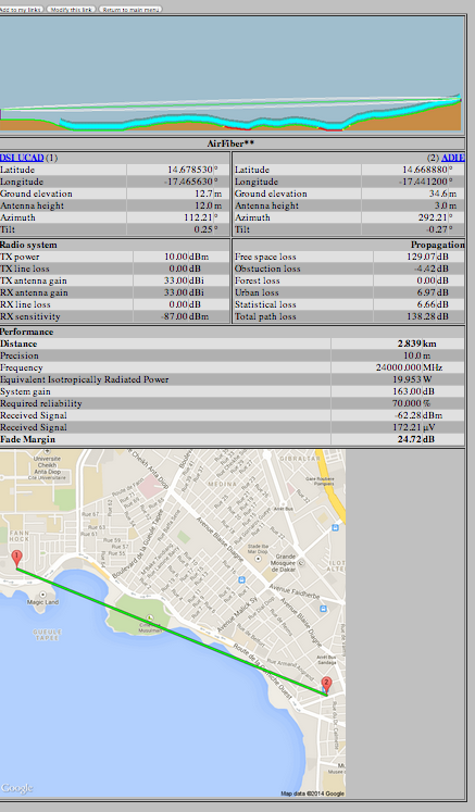
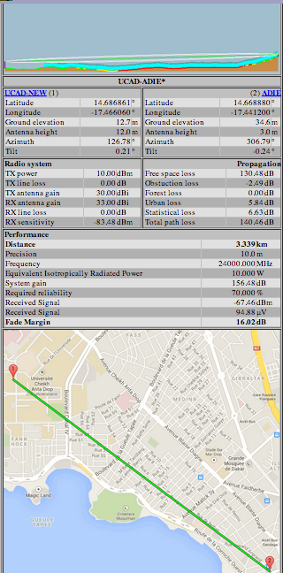
| Ermanno P @ ICTP | Site Profile | Old profile from DSI | New profile Fac Med - ADIE |
https://maps.google.com/?ll=14.67585,-17.454014&spn=0.023207,0.028067&t=h&z=15
UBNT AirFiber? MIB (for measuring link characteristics:
http://dl.ubnt.com/airfiber-fw-internal/AF.v1.5-Beta1/UBNT-MIB.txt
http://www.spectrumwiki.com/wiki/
Question: what's the max EIRP allowed in Senegal for 24 GHz ?
http://www.cplus.org/rmw/rmonline.html
http://www.wunderground.com/personal-weather-station/dashboard?ID=IDAKARDA2#history
http://www.digitalairwireless.com/files/airFiber-1Gbps-24Ghz_1332965263.pdf
Workplan
- verify status of licensing (may we turn the equipment on ?)
- site survey
- physical access to both locations
- UCAD: access to roof of building, get LOS to ADIE
- ADIE: access to roof of building, get ADIE to LOS
- physical access to both locations
- cable path
- grounding of equipment + copper for grounding (run cable)
- lightning arrestors
- cable safety (attachment, type of cable (outdoor, STP/UV protected)
- mounting of equipment (pipe/tower/mast) ?
- IP considerations, integration into campus
- monitoring considerations (see MIB) for signal/GPS/throughput
- rain data for Dakar (June to October is rain season)
- already something
- correlate signal / rain / time etc.
- rain data for Dakar (June to October is rain season)
Last modified 5 years ago
Last modified on Jul 29, 2014, 2:42:11 PM
Attachments (3)
- adie-ucad-link-profile.png (172.4 KB) - added by admin 5 years ago.
-
image.png
(1.0 MB) -
added by admin 5 years ago.
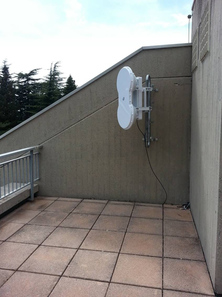
Mounting airfiber (example)
-
UCAD-ADIE-Profile.png
(182.8 KB) -
added by admin 5 years ago.
New link profile from Fac Med to ADIE
Download all attachments as: .zip